

Gresham Road Map
by Oregon Blue Print Company 1940s
Gresham, Multnomah County, Oregon, United States
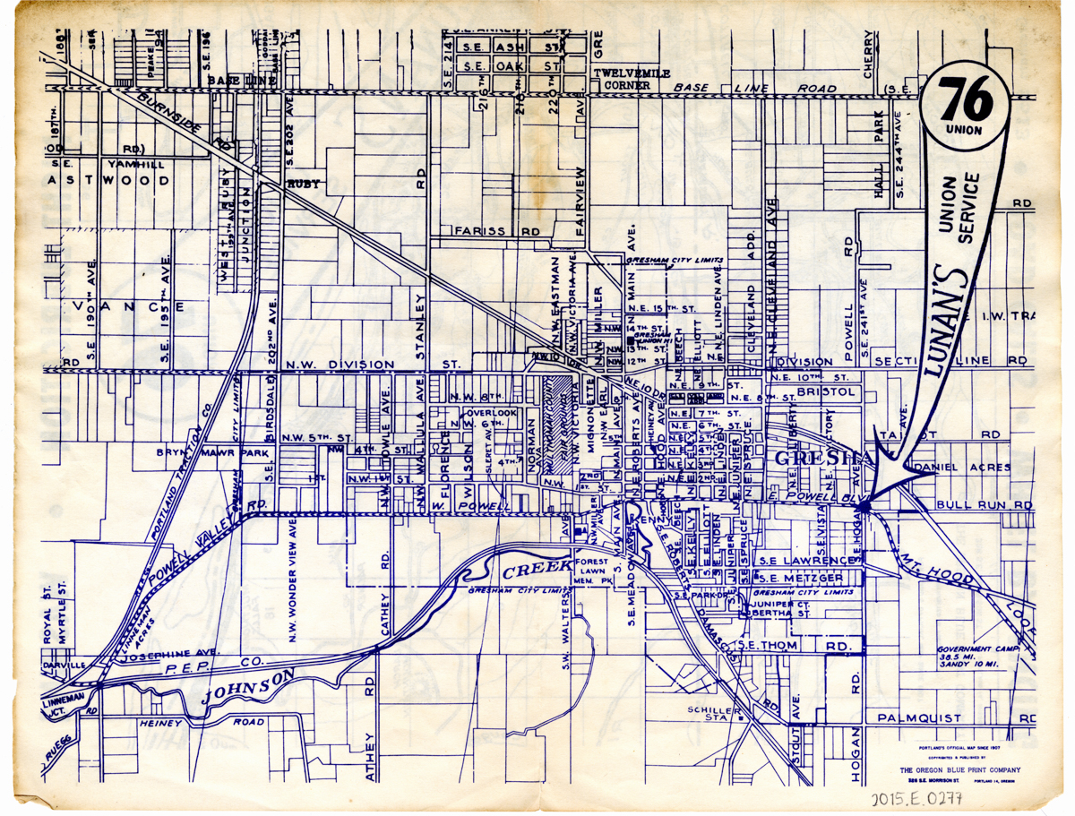
A double-sided road map made by the Oregon Blue Print Company for Lunan's Union Service, in Gresham. On one side is a road map of eastern Multnomah County, centering on Gresham, with parts of Clackamas County and southern Washington also visible. On the other side is split between an 8.5x11 road map of Gresham city and an advertisement for Lunan's Union Service. The ad includes a photo of Lunan's. The map folds into quarters.
More about this item
- Description
- A double-sided road map made by the Oregon Blue Print Company for Lunan's Union Service, in Gresham. On one side is a road map of eastern Multnomah County, centering on Gresham, with parts of Clackamas County and southern Washington also visible. On the other side is split between an 8.5x11 road map of Gresham city and an advertisement for Lunan's Union Service. The ad includes a photo of Lunan's. The map folds into quarters.
- Provenance
- Found in collections. The exact date of the map's production is unclear, but the Union 76 brand was introduced in 1932, and the PEPCo rail line name generally fell out of use by 1950, dating this approximately to the 1940s.
- Date
- 1940s
- Creator
- Oregon Blue Print Company
- Lunan's Union Service
- Subject
- Automobile mechanics
- Automobile service stations
- Maps
- Advertisements
- Gresham, OR
- Location
- Gresham, Multnomah County, Oregon, United States
- Rights
- http://rightsstatements.org/vocab/InC-RUU/1.0/
- Identifier
- ghs2015e0277
- Contributor
- Gresham Historical Society
- Extent
- Map
- Type
- Image
- Item sets
- Gresham Heritage
Part of Gresham Road Map
